|
|
Post by henson59 on Sept 12, 2012 10:13:27 GMT -5
I was just curious if any of you use topo maps or aerial photos of your property to help you scout and determine possible stand locations.
If you do where did you get them?
|
|
Deleted
Deleted Member
Posts: 0
|
Post by Deleted on Sept 12, 2012 10:23:03 GMT -5
I use them constantly. I print them off Google Earth. You can mark boundaries, add pins for stand locations, draw in trails...the possibilities are endless.
|
|
|
|
Post by 629powerport on Sept 12, 2012 10:27:51 GMT -5
Yes I have 8 aerial maps that I laminated and keep in my truck, I use them every year.
I printed mine off of google earth.
|
|
|
|
Post by henson59 on Sept 12, 2012 10:31:34 GMT -5
I looked at my property with google earth and it was almost hard to tell where some stuff was at because the entire property is timber. But I only looked for a couple minutes. I will play around with it. sounds like a great tool.
|
|
Deleted
Deleted Member
Posts: 0
|
Post by Deleted on Sept 12, 2012 10:33:23 GMT -5
If you look at the tools, you can change the years of the photos. This will let you see it at various stages of cover. Some are taken in the peak of canopy in summer, but some are taken in the late fall or early spring when you can see right down to the ground.
|
|
Deleted
Deleted Member
Posts: 0
|
Post by Deleted on Sept 12, 2012 12:29:23 GMT -5
topozone.com will make you a aerial in several sizes.
|
|
|
|
Post by freedomhunter on Sept 12, 2012 12:54:25 GMT -5
inmap.indiana.edu/viewer.htmgood one for Indiana, state funded has several years aerials and you can overlay contours, also has the old quad maps
|
|
|
|
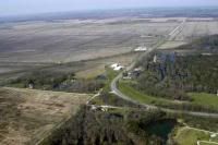
Post by goosepondmonster on Sept 12, 2012 13:34:11 GMT -5
|
|
|
|
Post by henson59 on Sept 12, 2012 14:14:00 GMT -5
Oh thanks guys! this is exactly what I was hoping to find!
|
|
|
|
Post by Hoosier Hunter on Sept 12, 2012 14:49:57 GMT -5
Land has changed around me. Google Earth stills shows my driveway as gravel and I had it paved in 2002. Over 10 years old.
|
|
|
|
Post by MuzzleLoader on Sept 12, 2012 16:24:05 GMT -5
........www.dearborncounty.org/Government/County-Offices/GIS. You can look up any county you like. Its free to use! Alot easier than bouncing around from site to site. Its all right there.
|
|
Deleted
Deleted Member
Posts: 0
|
Post by Deleted on Sept 12, 2012 16:31:27 GMT -5
Some of the tract boundaries are off somewhat (or by a lot in some cases) but it is a great way to get a general idea.
|
|
|
|
Post by M4Madness on Sept 12, 2012 16:32:01 GMT -5
I use Google Earth for aerial photos, MapTech.com to view topos online, and have a county platbook for property lines and ownership. Lawrence County doesn't have any GIS information online.  |
|
Deleted
Deleted Member
Posts: 0
|
Post by Deleted on Sept 13, 2012 6:14:02 GMT -5
Good Maps can be a greating scouting Tool.
|
|
|
|
Post by 36fan on Sept 13, 2012 10:20:02 GMT -5
Depending on the county, you can use Beacon: beacon.schneidercorp.com/They have Aerial photos and plats on different layers. The counties that have not supplied GIS info still have property ownership records available |
|